
![[Title] Spectacular View! Complete Cycling Report to Mt. Kirosan Observatory](https://touring-shimanami.com/wp-content/uploads/2025/10/mtkiroe-ogp.png)
The Mt. Kirosan Observatory Park on Oshima is one of the most popular scenic viewpoints along the Shimanami Kaido. Can beginners ride a rental bike up to the top? How difficult is it? How long does it take? In this article, I’ll share a detailed report to answer all these questions.
Hi, I’m Yuki Kawai — a touring cyclist based along the Shimanami Kaido. Having cycled this route more than 300 times, I created this site to share practical, experience-based tips for anyone planning a cycling trip here. I hope it helps you make the most of one of Japan’s most beloved cycling destinations.
About Mt. Kirosan observatory park
A signature scenic spot of the Shimanami Kaido
Mt. Kirosan is located on Oshima, one of the six islands that make up the Shimanami Kaido route across the Seto Inland Sea, connecting Onomichi in Hiroshima Prefecture on the Honshu side and Imabari in Ehime Prefecture on the Shikoku side. In recent years, the Shimanami Kaido has gained worldwide recognition as a top cycling destination. Cyclists from all over the world, from beginners to experienced riders, enjoy exploring it by road bike or rental bicycle.
![[Illustration] Mt. Kirosan Observatory Park: A map showing the location of Mt. Kirosan along the Shimanami Kaido](https://touring-shimanami.com/wp-content/uploads/2025/10/kirosanloc-e.png)
On the southern side of Oshima, in Yoshiumi Town, stands Mt. Kirosan, which rises to an elevation of 307 meters. At its summit, the Mt. Kirosan Observatory Park offers one of the best panoramic viewpoints along the Shimanami Kaido, making it a must-see destination for visitors.
- The most famous viewpoint on the Shimanami Kaido
- The route and difficulty of cycling up to Mt. Kirosan Observatory
- Tips for beginners riding up the mountain
A panoramic view that defines the Shimanami Kaido
The view from Mt. Kirosan is so iconic that it appears in almost every video, brochure, and guidebook introducing the Shimanami Kaido. The breathtaking sight of huge bridges stretching across the sea and connecting the many islands of the Seto Inland Sea captivates every visitor. It’s truly the kind of scenery that makes you think, “This is the Shimanami Kaido!”
| Observatory | Mt. Kirosan Observatory Park |
|---|---|
| Address | 487-4 Minamiura, Yoshiumi-cho, Imabari City |
| Opening Hours | Open 24 hours |
| Elevation | Mt. Kirosan: 306 m / Parking area: 295 m |
| Architectural Design | Kengo Kuma & Associates |
| Completion | March 1994 |
| Forest Road | “Mt. Kirosan Line” – 2.8 km in length |
| Gradient | Average: 9% / Maximum: 15% |
| Difficulty | One of the toughest hill climbs on the Shimanami Kaido (for advanced riders) |
Views from the observatory
The Mt. Kirosan Observatory has two decks: “Observation Deck A” and “Observation Deck B”. The observatory building itself is long in the northwest–southeast direction; the southeast-side deck is Observation Deck A, and the northwest-side deck is Observation Deck B.
![[Photo] Mt. Kirosan Observatory Hill Climb: Observation Deck A and Observation Deck B](https://touring-shimanami.com/wp-content/uploads/2023/02/kirosan-obsevatory-48.jpg)
The famous panoramic view with the Kurushima Kaikyo Bridge below is visible from the northwest-side Observation Deck B. From the observatory entrance, it is located up and to the right.
What you see from Observation Deck B
![[Photo] Mt. Kirosan Observatory Hill Climb: Explanation of the westward view from Observation Deck B](https://touring-shimanami.com/wp-content/uploads/2025/10/deckb-e.jpg)
![[Map] Mt. Kirosan Observatory Hill Climb: Direction of the view from Observation Deck A](https://touring-shimanami.com/wp-content/uploads/2023/02/to-west-kirosan.jpg)
From Observation Deck B you are looking roughly west. Centered in the view is the roughly 4-kilometer-long Kurushima Kaikyo Bridge, which links Imabari on the Shikoku mainland with Oshima. From here you can see the islands of the Kurushima Strait and, on clear days, islands along the Tobishima route and even parts of Honshu in the distance. The Kurushima Kaikyo Bridge is the longest bridge on the Shimanami Kaido and spans the Kurushima Strait, a historically challenging channel for marine navigation.
What you see from Observation Deck A
![[Photo] Mt. Kirosan Observatory Hill Climb: Explanation of the southeastward view from Observation Deck A](https://touring-shimanami.com/wp-content/uploads/2025/10/decka-e.jpg)
![[Map] Mt. Kirosan Observatory Hill Climb: Direction of the view from Observation Deck A](https://touring-shimanami.com/wp-content/uploads/2023/02/to-east-kirosan.jpg)
The view from Observation Deck A is completely different from Deck B — here you’ll see a wide-open seascape stretching to the horizon. This photo shows the southeastward view from the observatory. You can spot islands such as Hikijima and Heichijima, and on clear days, you can see as far as the Ishizuchi Mountain Range in Saijo City on Shikoku.
Always ranked among Japan’s top viewpoints
Ranked No. 2 in “Japan’s Best Scenic Viewpoints You’ll Want to Visit”!
Mt. Kirosan Observatory Park has consistently been featured in major ranking lists of Japan’s best viewpoints. On the travel review site TripAdvisor, it was ranked 3rd in the 2016 “Japan’s Best Scenic Viewpoints You’ll Want to Visit” and rose to 2nd place in 2017. It also took 2nd place nationwide in the 2022 Nikkei Plus 1 “Anything Ranking” by the Nikkei newspaper. Many travelers say, “If I go to the Shimanami Kaido, I definitely want to visit Mt. Kirosan,” making it one of the most talked-about spots among cyclists as well.
Designed by architect Kengo Kuma
Mt. Kirosan Observatory is also famous as an architectural work. It was designed by renowned Japanese architect Kengo Kuma, who also designed Japan’s National Stadium in Tokyo. Completed in 1994, the observatory is partially embedded into the mountaintop itself. This design makes the structure blend naturally into the landscape, so it doesn’t stand out when viewed from the outside.
An “invisible architecture” that blends with the landscape
At the summit of Mt. Kirosan on Oshima Island, we experimented with the idea of “making architecture disappear.” The mountaintop had been flattened and developed as a park, so we restored it to its original terrain, added greenery, and created a slit in the landscape. Within that slit, we embedded a continuous sequence of spaces that form the observatory. Rather than an object-like, protruding structure, we proposed a “negative form” — an invisible architecture that appears as a hollow in the mountain.
Kengo Kuma and Associates
This innovative observatory, designed with great respect for the surrounding natural scenery, has been widely praised. Just one year after completion, it received the 1995 JCD Design Award (Excellence Award in the Culture and Public Facility category). In 2000, it also won several other architectural honors, including the 7th Public Building Award (Excellence Award) from the Public Buildings Association.
I recommend paying attention not only to the view but also to the observatory’s design and interior spaces!
AD (Google AdSense)
A hill climb known for its steep slopes
While Kirosan Observatory Park is famous for its stunning scenery and award-winning architecture, among cyclists it’s also well known as a challenging hill climb route on the Shimanami Kaido.
A maximum gradient of 15%!
Although the elevation of Mount Kirosan is only around 300 meters, which isn’t especially high for this area, the climb is quite steep — in just 3 to 4 kilometers, the slope reaches gradients of over 15% in some sections.
Many cyclists combine the Kirosan hill climb with rides of several dozen kilometers or even over 100 kilometers along the Shimanami Kaido. Many say, “The Kirosan climb was incredibly tough!” or “I had to stop several times on the way up.” There’s no other place along the Shimanami Kaido with such a steep gradient, so when paired with a long-distance ride, this hill feels especially demanding.
An average gradient of 9% on the forest road
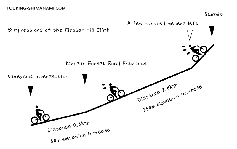
The only paved road leading up to Mount Kirosan, the Kirosan Forest Road, is about 2.8 km long. Since the starting point is at an elevation of around 50 meters, you’ll be climbing roughly 250 meters over 2.8 km. That works out to an average gradient of about 9%. The last few hundred meters are especially steep, with gradients of 10–15%. It’s quite a punishing climb!
As for how long the climb takes — that really depends on your fitness level and your bike. Experienced road cyclists might reach the top in about 20 minutes, while those using rental bikes could take around 40 minutes to an hour. I once walked this entire route myself, taking photos along the way, and it took me about an hour at a relaxed pace.
Can Beginners Climb It?
This is definitely a must-see viewpoint, but I honestly don’t recommend that beginners include the Mt. Kirosan hill climb in a Shimanami Kaido cycling plan using rental bikes.
- It can be extremely tiring, which may affect the rest of your ride.
- You might spend far more time than expected on the climb.
- The descent can be technical, with a risk of falls or accidents.
For those with extra time, one option is to walk up the hill instead of cycling. You could also use an electric-assist rental bike available near Kameyama Bus Stop for just the hill climb. Another alternative is to take a taxi from spots like the road park “Yoshiumi Iki-iki-kan” and skip this section by bike.
Reviews from beginner hill climbersThe early slope really broke my spirit. I ended up pushing my bike the whole way.
Several times I regretted coming, but the view at the top was breathtaking.
The steep descent was scary. I almost flew off at a curve.
Another observation deck, Itoyama Observatory, is easily accessible even for beginners and offers a wonderful view of the Kurushima Strait, so I personally recommend it.

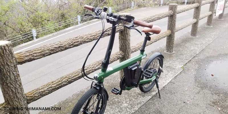
If you rent an electric-assist bike from the central rental terminal Sunrise Itoyama, it’s likely that you can climb Mt. Kirosan without much difficulty. Modern electric-assist bikes are especially powerful on steep slopes.
Access by public transportation
By bus (not bicycles)
Unfortunately, there are no bus routes that go directly to Mt. Kirosan Observatory Park, so you cannot reach the summit directly using public transportation. If you are not using a bike, car, or motorcycle, you would need to walk about 3.7 km from the nearest bus stop, Kameyama, on Route 317.
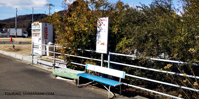
The buses are not very frequent, but from Imabari Station Bus Stop, the “Express Bus to Hakatajima” or the “Express Bus to Omishima Miyaura” stops at Kameyama. The ride from Imabari Station to Kameyama takes about 35 minutes by bus.
Access by car or motorcycle
On the Shimanami Kaido Expressway (Nishiseto Expressway), there are two interchanges on Oshima: “Oshima-kita IC” and “Oshima-minami IC.” The interchange you should use depends on which direction you are traveling from. If you are coming from the Onomichi (Honshu) side, use Oshima-kita IC to exit onto Oshima. If you are coming from the Imabari (Shikoku) side, use Oshima-minami IC. Oshima-minami IC is located at the foot of Mt. Kiro, making it a very convenient access point.
When leaving Oshima, be careful to use the correct interchange depending on your destination. If you are heading toward Honshu, enter the expressway via “Oshima-kita IC.” If you are heading toward Shikoku, use “Oshima-minami IC.”
The summit parking lot is not very large
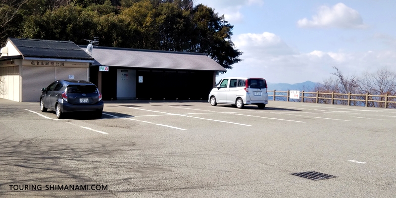
The parking lot at the summit of Mt. Kiro is free to use, but it only has space for 18 standard cars. On weekdays, it usually does not fill up except during busy times such as around sunset. However, during peak tourist seasons, traffic jams can sometimes form near the top of the mountain. Please note that there is almost no space to make a U-turn once you start driving up, all the way until you reach the summit parking area.
| Parking lot | Mt. Kiro Observatory Park Parking Lot |
|---|---|
| Location | Google Maps |
| Parking fee | Free |
| Capacity | 18 standard cars / 6 large vehicles |
Visiting the Mt. Kiro Observatory during major holiday periods such as Golden Week can be extremely difficult. Cars waiting to enter the parking lot often create heavy traffic jams that stretch far down the mountain road. If you go by car, it is not unusual to wait in line for two to three hours. Some people even park illegally along the roadside, making the congestion even worse. Even if you go by bicycle, you may need to climb while weaving through stopped traffic, with cars also coming downhill at the same time. The situation can become quite chaotic.
AD (Google AdSense)
Hill climb report
From here, I will share my personal report based on cycling up Mt. Kirosan and exploring the area on site.
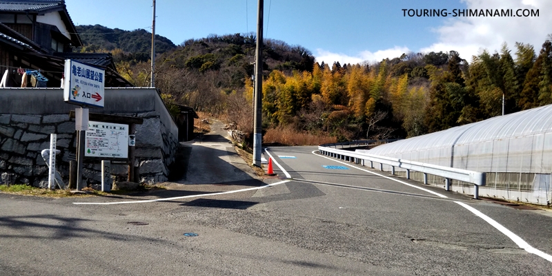
Starting at Kameyama intersection
The climb to Mt. Kirosan Observatory starts at the Kameyama Intersection on Route 317, the main Shimanami Kaido route. Coming from the Imabari side, this is the first signal after passing Oshima Minami IC.
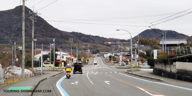
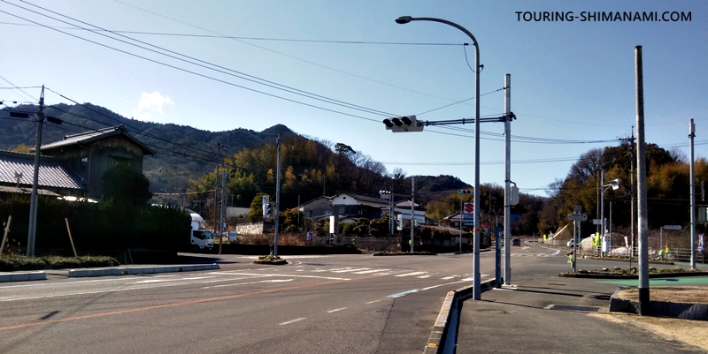
If you come from the Imabari side, turn right at this Kameyama Intersection. From the Onomichi side, turn left. The next photo shows this intersection from the opposite direction.
This is the view when you get off the express bus at Kameyama Bus Stop. The photo above shows the Kameyama Intersection looking toward Imabari. The road in the direction where the truck is parked leads to Mt. Kirosan.
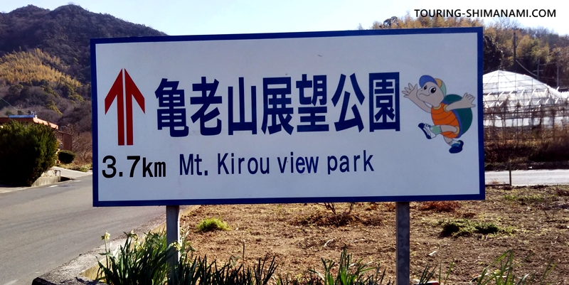
Heading toward Mt. Kirosan from the intersection, look for this large sign reading “↑ Mt. Kirosan Observatory 3.7 km” as a helpful landmark.
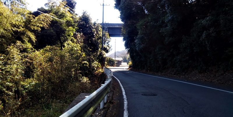
From Kameyama Intersection to the starting point of the forest road “Kirosan Line”, ride about 800 meters along a gentle incline, gaining roughly 50 meters in elevation. Along the way, you will pass under the Shimanami Kaido Expressway. Keep an eye out for signs such as “Kirosan Entrance 50 m ahead” so you don’t miss the road entrance.
This is where the real hill climb begins…
Starting point of Forest Road “Kirosan Line”
You’ve reached the starting point of the forest road “Kirosan Line”, the true entrance to the hill climb up to Mt. Kirosan Observatory. At this stage, your breathing might already be a bit heavy… the climb ahead looks challenging.
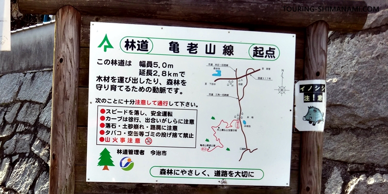
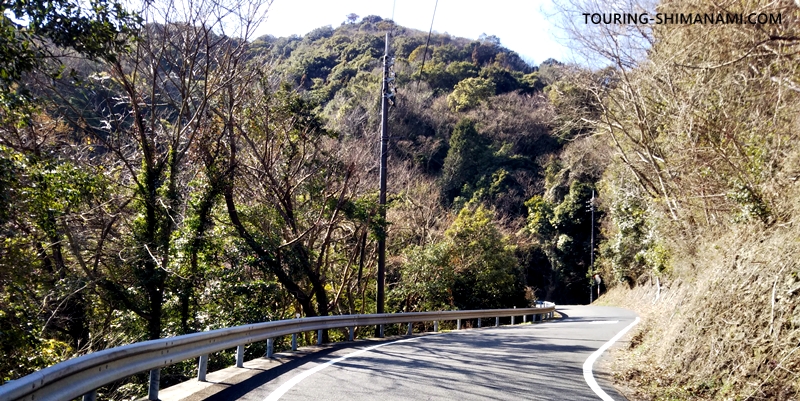
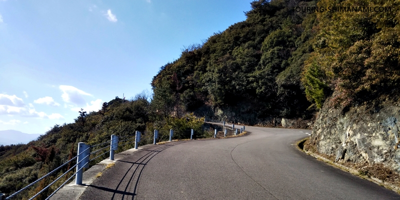
From here to the Mt. Kirosan Observatory parking lot, the road is a forest road managed by Imabari City. Although it’s called a forest road, it’s fully paved and wide enough for vehicles to pass each other safely. That said, the road has many winding sections and consecutive blind curves. Cyclists should watch out for cars and buses, and drivers should be cautious of cyclists along the way.
Start of the full climb
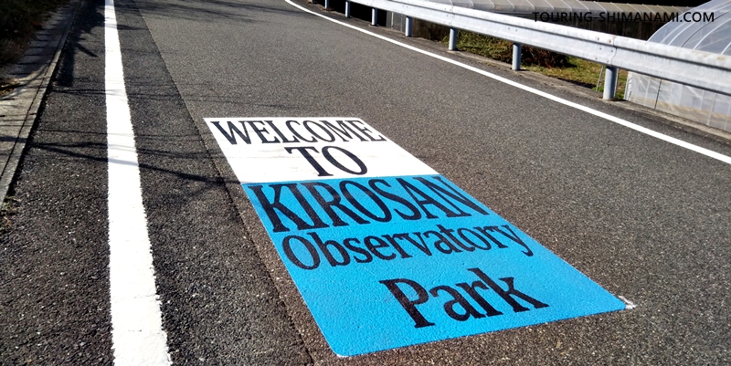
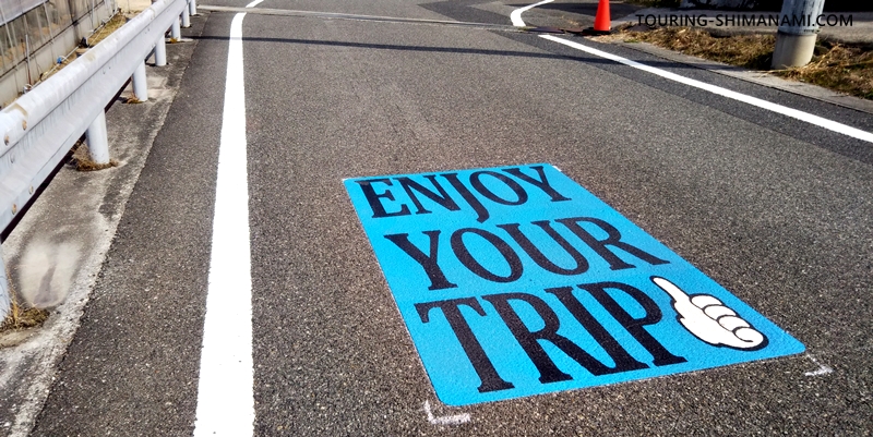
At the start of the forest road, there are English road markings creating a welcoming atmosphere for cyclists heading to Mt. Kirosan Observatory. I don’t remember seeing them on my previous visit, so they were likely added fairly recently. These little touches can make the climb feel a bit more cheerful.
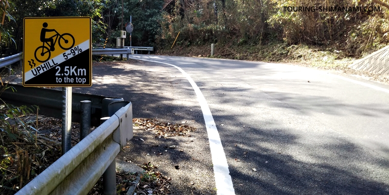
Along the Kirosan Line, you’ll find signs indicating the remaining distance and gradient. At the start, the 2.5 km mark shows an average gradient of 5–9%. Some sections inside curves are steeper. While it might be tempting to zigzag up the slope, oncoming vehicles make it safer to stick to the left and push forward steadily.
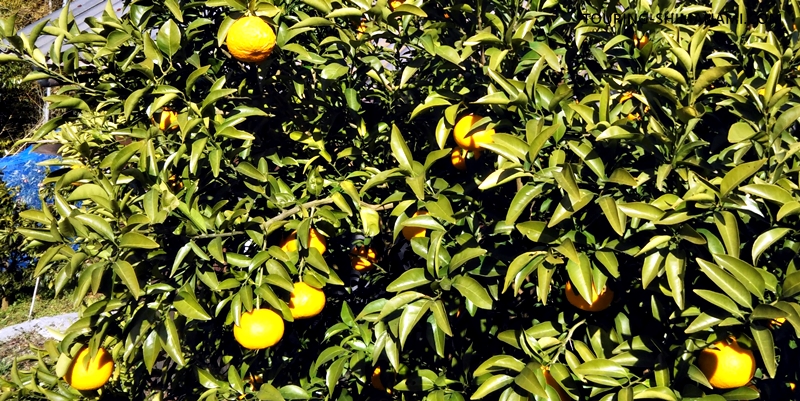
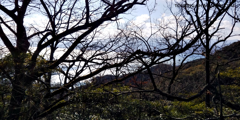
During the early part of the climb, the scenery includes farmland and orchards. The citrus trees are especially iconic of the Seto Inland Sea region, with branches heavy with ripe, tempting fruit.
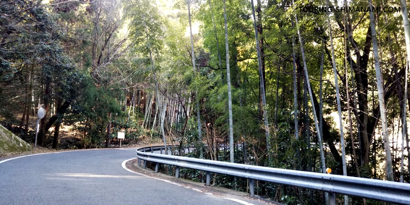
After passing the orchard zone, reaching the prominent bamboo grove brings a slight relief in the gradient. There are hardly any completely flat sections, but this stretch feels the gentlest along the climb.
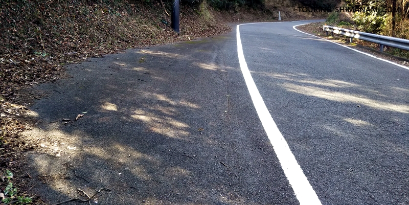
Along the forest road, there are several shoulder spaces designed for vehicles to pass. If you need to stop for a break during the climb, these areas are ideal. I made sure to take hydration breaks whenever I came across one of these spots.
Henro path and Murakami Yoshihiro’s grave
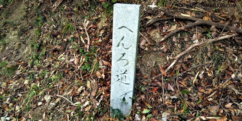
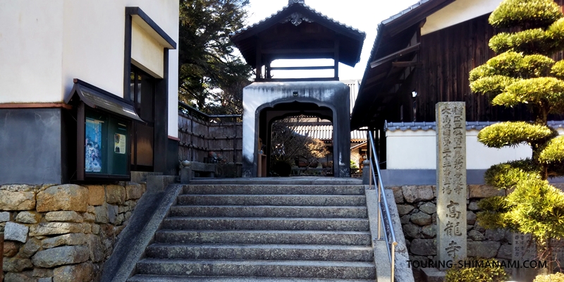
Along the route, you’ll see numerous stone pillars marking the “Henro path.” The term “Henro” refers to the Shikoku pilgrimage visiting 88 temples following the footsteps of Kobo Daishi. Around Shikoku, there are many smaller pilgrim paths inspired by this route. On Oshima, there are 88 temples and hermitages, known collectively as “Oshima’s Island Shikoku.” Around Kirosan, several pilgrimage sites, including Koryuji Temple, line the forest road, making it a route also used for spiritual journeys.
Along the forest road, I discovered a small shrine with a mirror. Kirosan was once a place where monks practiced ascetic training. When you’re fatigued from the climb, it’s easy to overlook, but sacred spots like this are scattered along the route.
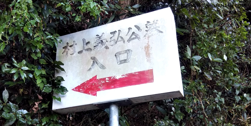
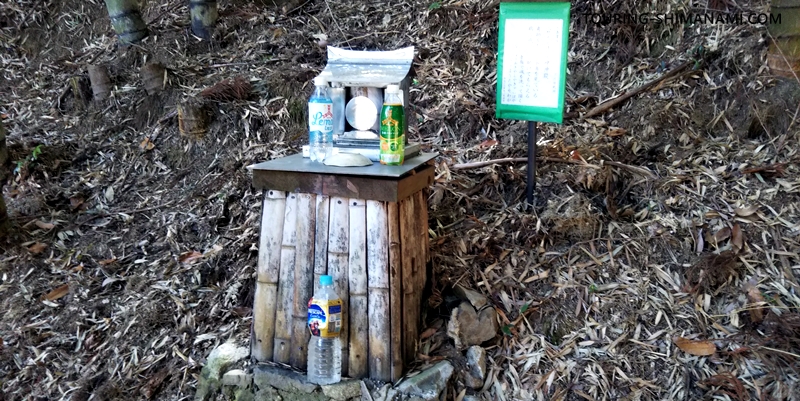
About halfway up the forest road (1.6 km remaining, elevation 142 m), I came across a sign for the entrance to Murakami Yoshihiro’s grave. A narrow, pedestrian-like path continues from here. Following it leads to a small hall, Myohodo, which is temple number 34 of the Island Shikoku pilgrimage, and next to it is the grave (memorial tower) of Murakami Yoshihiro, a warrior from the Nanboku-chō period considered the founder of the Noshima Murakami naval clan. It’s worth a visit if you’re interested in history.
1 km remaining
After passing the entrance to Murakami Yoshihiro’s grave, the sky opens up slightly and the summit feels closer. Just a bit more to go! After a hairpin curve, the mountain shifts from the left side to the right, and the slope feels a bit steeper.
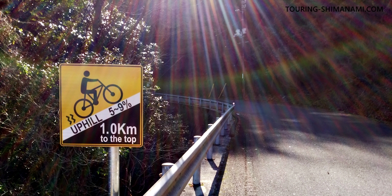
After taking several breaks, I reached the sign showing 1 km remaining to the summit of Kirosan. The sign indicates a slope of 5–9 %. Truly, there are almost no flat sections, and it feels like you’re climbing continuously. At this point, the elevation is 199 m, about one-third of the total climb.
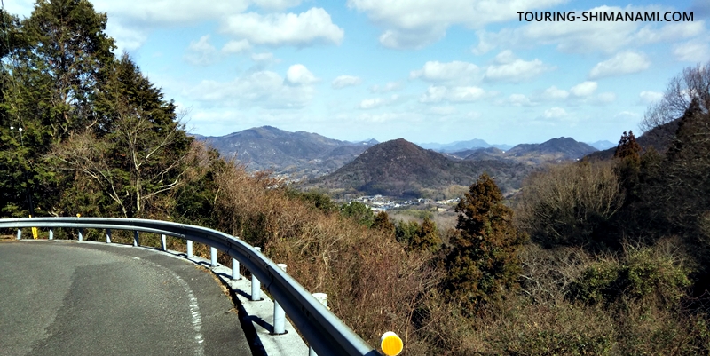
During a short break, I looked back and caught a glimpse of Yoshiumi town. The triangular shape of Yawata Mountain popped out in the distance. Up until this point, the path had mostly been forested mountain road with little view.
Sea comes into view = Slope gets steeper
As I continued up the slope, the sky finally opened up and the sea became visible beyond the trees. The land in the distance is downtown Imabari. While the beautiful sea view is exciting, this section also comes with a steeper gradient, making the climb more challenging.
It’s hard to capture in a photo just how steep this section feels. I took a shot from the side to better illustrate the incline, which gives some sense of the challenge.
On the right side of the road, rugged rock faces appear, while the sea view opens up on the left. Although I knew the summit of Kirosan was near, by this point I was completely exhausted and had little energy to enjoy the scenery.

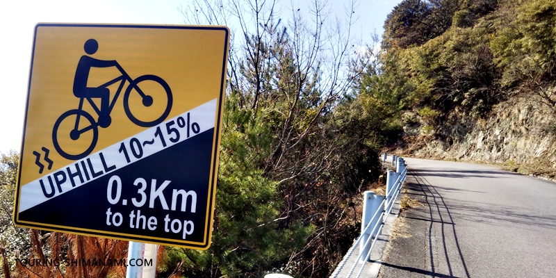
Steep section in the final few hundred meters
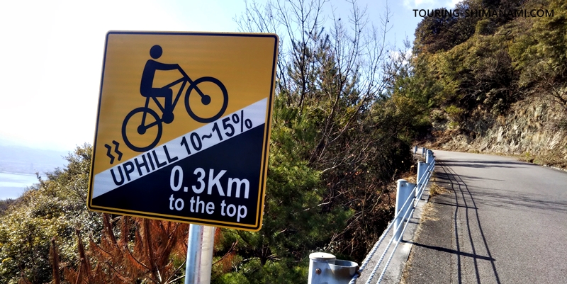
Finally, the last sign appears. Only 0.3 km to the Kirosan summit, with an uphill gradient of 10–15%! This is the steepest section on the entire forest road. To avoid exhausting myself for the rest of the trip, I decided to walk my bike up this section. Even walking the bike is quite challenging.
As I neared the summit, a small viewing area appeared. From here, you can see the Kurushima Kaikyo Bridge, but I wanted to save the full view for the Kirosan Observatory. I kept my eyes down and walked straight ahead, resisting the temptation to glance at the left-side scenery, so I could fully appreciate the moment at the top.
Arrival at the summit
Finally, I reached the parking area at the summit of Kirosan Observatory. Including breaks and stopping to take plenty of photos along the way, the climb took about one hour.
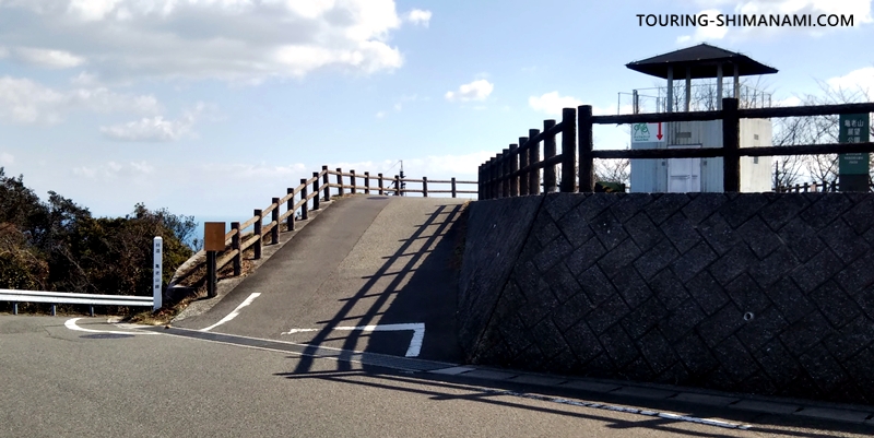
Cars and motorcycles also enter the parking area from here. The road straight ahead leads to the larger parking spaces for tour buses and other large vehicles.
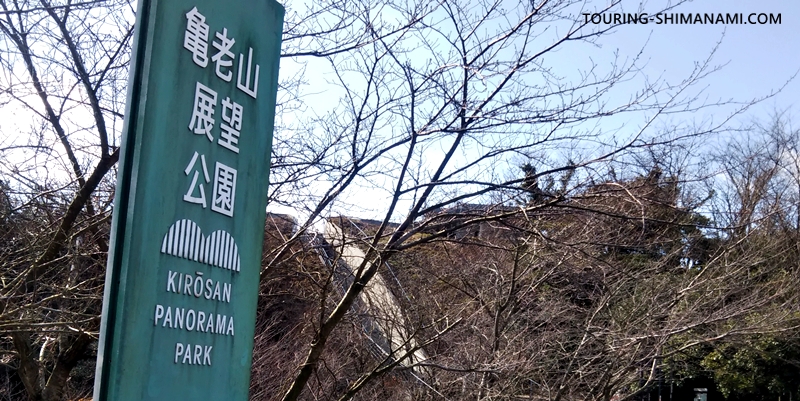
The sign for Kirosan Panorama Park. Since this was a weekday in January, the park was very quiet—no tour buses and only 2–3 cars in the parking area. When I visited on a holiday previously, both cars and cyclists were much more numerous. Today, it feels like a peaceful visit without crowds.
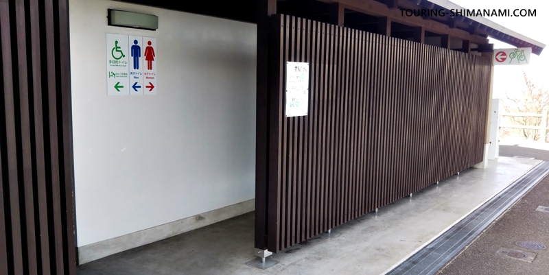
The summit parking area at Kirosan Panorama Park is equipped with a flush toilet. There are no facilities such as restrooms along the climb, so it’s great to have a clean toilet available here.
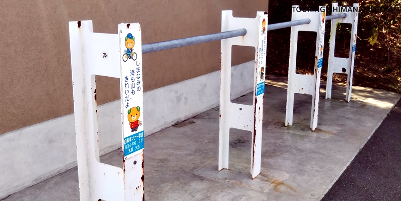
Next to the public toilet, on its right side, there is a sturdy metal bicycle rack that can accommodate around 10 bikes. There is also space along the nearby railing or wall to lean bikes, so finding a place to park your bike shouldn’t be a problem.
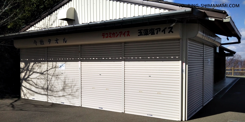
The Kirosan shop was closed during my visit. It appears to remain closed in winter, and even on weekdays outside of winter, it may occasionally be closed temporarily. It’s best not to get your hopes up too high for the “Seaweed Salt Ice Cream” sign—otherwise, the disappointment can be real if it’s not available after a tough climb.
A later visit to the Kirosan Shop
On a later visit when the Kirosan shop was open, I had the chance to check it out. As expected, the most popular item here is the “Seaweed Salt Ice Cream”!
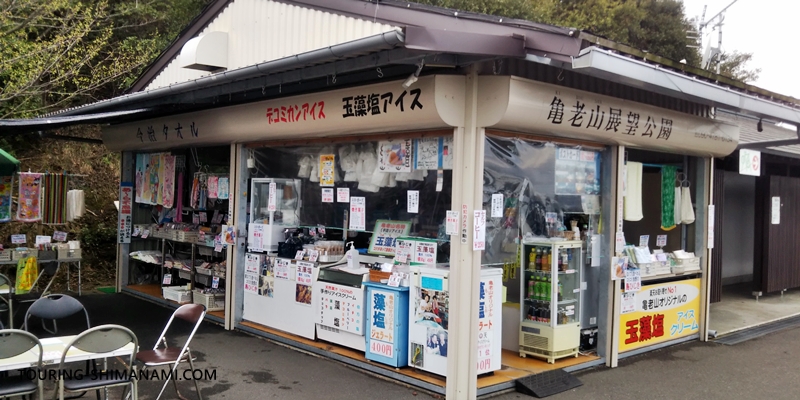
Besides the seaweed salt ice cream, the shop also sells bottled drinks, coffee and sweets, and souvenirs such as Imabari towels. The staff seemed a bit curt, but that’s part of the charm.
There used to be a small shop at the summit of Mt. Kiro that was famous for its “moshio ice cream,” flavored with traditional sea salt from the Setouchi region. However, the shop closed at the end of 2025, and the building has since been demolished. The site is now vacant, although Imabari City sometimes operates a temporary stand there as a trial project, selling locally produced Ehime mikan juice. I hope to see new developments there in the future.
Time to head to the Kirosan observatory
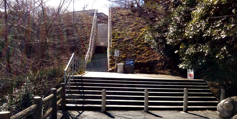
After parking the bicycle in the rack, I headed on foot to the observatory. It’s very close to the parking area.
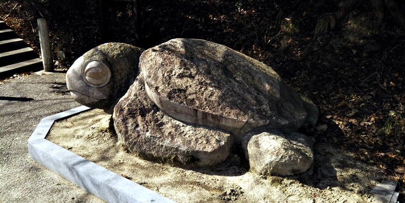
Along the way, there is a turtle statue. It was created by local residents based on the legend that gave Kirosan its name.
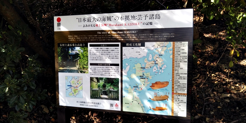
As a memory of the Murakami Navy, the Shimanami Kaido area has numerous cultural assets registered as Japan Heritage sites. While Kirosan itself is not part of the registered assets, Koryuji Temple, the family temple of Lord Murakami Yoshihiro, and his grave are recognized as cultural heritage.
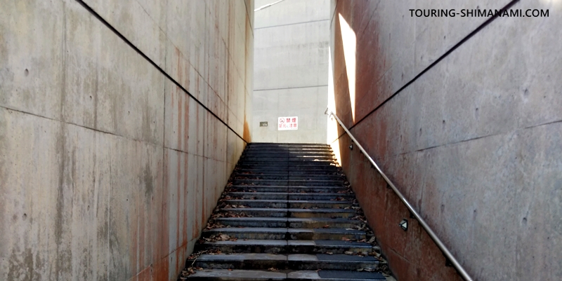
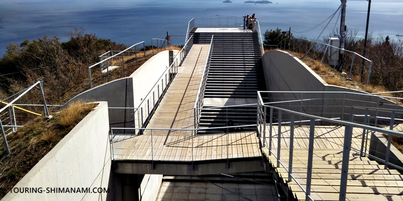
Approaching the observatory, you climb a staircase and pass through a narrow corridor flanked by raw concrete walls on both sides.
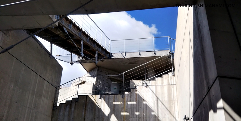
Head toward Observation Deck B. After exiting the corridor into a wider open space, turn right. If you take the wide staircase on the left, you can reach Observation Deck A. There is no fixed route—you can move freely.
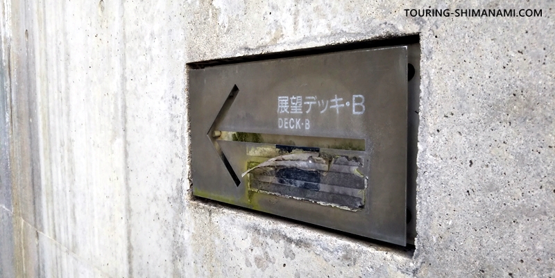
Small plates embedded in the floor guide visitors toward Deck B. Even if you ascend toward Deck A, you can reach Deck B via a separate route from there.
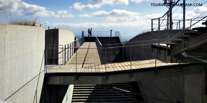
The intersecting corridors create an intricate and striking architectural impression. The combination of exposed concrete and wooden deck-style corridors reminds one of the blend of wood and concrete seen in the New National Stadium in Tokyo.
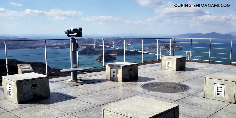
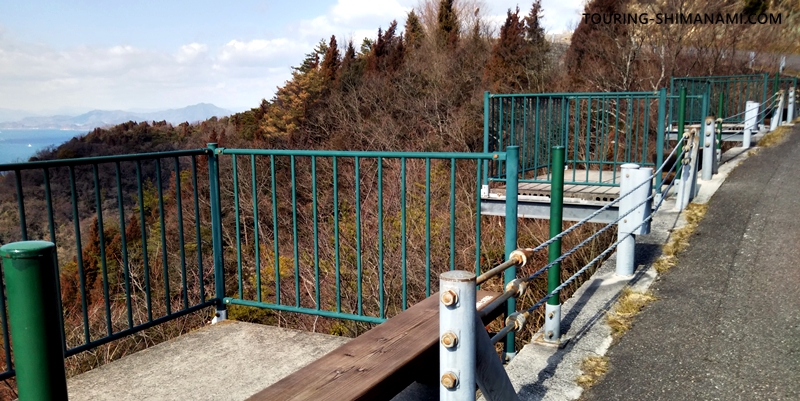
We’ve reached Observation Deck B at Kirosan Panorama Park! Concrete benches are available, so you can sit and relax while enjoying the view. It’s fun to observe the passing ships and surrounding islands with binoculars. Be aware that some days can be very windy, as there is nothing to block the wind. Walking from the parking lot to the observation deck takes about 20 minutes.
Kirosan Panorama Park is also famous for sunrise and sunset views. The Seto Inland Sea turning red at sunset is truly beautiful. However, cyclists should be cautious: after watching the sunset here, descending the slopes of Ōshima in the dark can be dangerous, so keep an eye out for wildlife such as wild boars.
The island’s cycling roads get really dark and scary after dark…
Be careful on the downhill
The trickiest part of Kirosan’s climb is actually after enjoying the view! The downhill ride is quite technical. There are many blind curves, and depending on the season and time of day, a significant number of cars may be coming up the hill, so please be very careful.
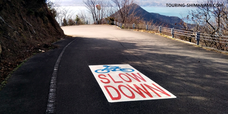
The downhill section at Kirosan is known for a high number of bicycle accidents. That’s why “Slow Down” markings have recently been painted on the road at several spots. Be mindful of front-wheel lock-ups and use both front and rear brakes to reduce your speed safely.
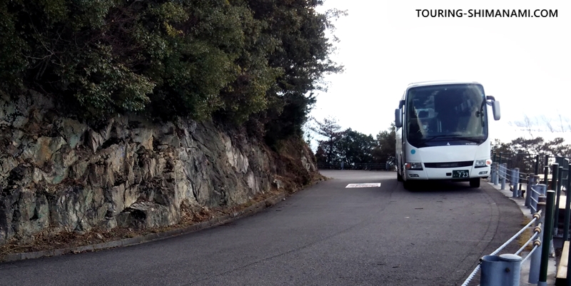
Kirosan Panorama Park is a must-visit spot not only for cyclists but also for bus tours. Large sightseeing buses frequently come up the hill, so stay alert. Unlike Karei-yama, there’s no quarry, so you won’t encounter large trucks, but caution is still essential.
So, be safe and enjoy your trip!
AD (Google AdSense)
Nearby attractions
Here are some attractions, restaurants, and shops around Kirosan. When visiting Ōshima on the Shimanami Kaido, be sure to check these spots as well—they offer unique experiences you won’t find anywhere else.
Koryuji Temple at Kirosan
Koryuji Temple is the oldest temple on Oshima, located at the foot of Kirosan. Although it was once in ruins, it was rebuilt in 1080 (Jōryaku 4) by Murakami Nakasue, the ancestor of the Murakami clan of Shinano. It later became the family temple of Murakami Yoshihiro, a commander of the Murakami Kaizoku (Murakami pirates), which helped it grow into a major temple. Originally, several temples were located along the mid-slope of Kirosan, but after fires and other events, the temple was established at its current location at the base. It is truly a temple that preserves Oshima’s history. Cyclists often stop here for the traffic-safety charms featuring bicycles or Shimanami Kaido designs.
| Visit | Koryuji Temple |
|---|---|
| Address | 2916-2 Yoshihaimachi, Imabari |
| Highlight | Family temple of Murakami Yoshihiro, Murakami pirate commander |
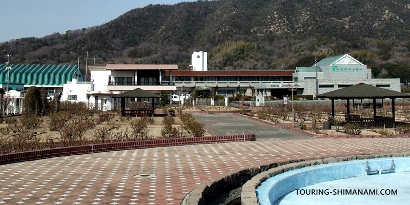
Yoshiumi Ikiiki-kan roadside station
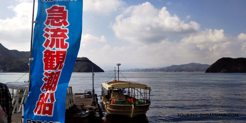
After enjoying the spectacular view of the Kurushima Strait from Kirosan, you might feel like cruising through the strait by boat. From Oshima’s roadside station, Yoshiumi Ikiiki-kan, the daily Kurushima Strait Rapid Current Sightseeing Boat departs, offering a thrilling experience of one of Japan’s three fastest tidal currents. From the boat, you can also look up at the Kurushima Kaikyo Bridge from below, creating an impressive perspective. Depending on the season and time, you might even witness dramatic whirlpools.
| Roadside Station | Yoshiumi Ikiiki-kan |
|---|---|
| Address | 4520-2 Yoshiumimachi, Imabari |
| Hours | 9:00–17:00 |
| Closed | Occasional winter closures |
| Highlight | Famous for seafood BBQ and Kurushima Strait sightseeing cruises |
Yoshiumi rose park
This is a free-entry park located in Yoshiumi Town, where Kirosan is situated. The park is home to 3,500 rose bushes representing 400 varieties, along with lawns and playgrounds. From May to June and October to November, the roses are in full bloom, giving the park a beautiful Western-style garden atmosphere. A small on-site shop offers rose-flavored ice cream, making it a popular spot for locals to relax as well.
| Sightseeing & Rest | Yoshiumi Rose Park |
|---|---|
| Address | 1290 Fukuda, Yoshiumi-cho, Imabari |
| Hours | Open year-round (no closing hours) |
| Highlight | Free-entry rose park featuring many rare old rose varieties |
Murakami Kaizoku Museum
The waters of the Kurushima Strait, visible from Kirosan, were once under the control of the Murakami Kaizoku (naval pirates). To learn more about this fascinating history, visit the Murakami Kaizoku Museum (formerly Murakami Suigun Museum). Located on the northern side of Oshima, it’s a bit of a distance from Kirosan. The museum, recognized as part of a Japan Heritage site, showcases the history of the Murakami pirates, lets you experience the waters around Noshima, and displays valuable artifacts from the Noshima Murakami family.
| Sightseeing | Murakami Kaizoku Museum |
|---|---|
| Address | 1285 Miyakubo, Miyakubo-cho, Imabari |
| Hours | 9:00–17:00 |
| Closed | Mondays |
| Admission | Adult ¥310 |
| Highlight | Learn about the history of the Noshima Murakami pirates |
Kameyama-goya
One of the recommended spots for lunch near Kirosan is the Asian restaurant Kameyama-goya. You can park your bike in the small parking area along the main route and walk a short path up a gentle hill to reach the cafe. Located near the Oshima Minami Interchange, the cafe sits on a small hill offering stunning views of the Kurushima Kaikyo Bridge. The menu includes authentic dishes like pho and lu rou fan, and their desserts are also highly recommended.
| Asian Cafe | Kameyama-goya |
|---|---|
| Address | 4674 Me, Yoshiumi-cho, Imabari |
| Hours | 11:00–17:00 |
| Closed | Monday–Thursday |
| Approx. Meal Price | ¥1,000–¥2,000 |
| Highlight | Asian cafe on a hill with views of Kurushima Kaikyo Bridge |
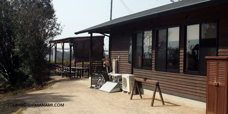
Koriori-sha
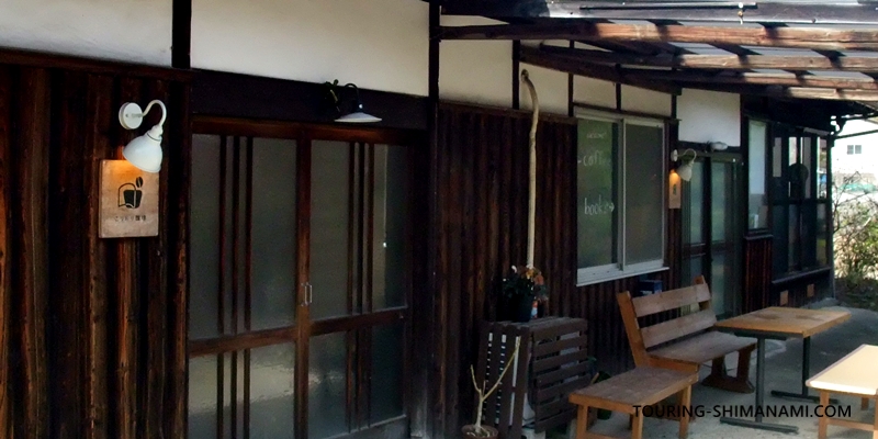
Located relatively close to Kirosan, Koriori-sha is a shop specializing in freshly roasted coffee and a curated selection of books. The owner roasts the coffee beans by hand and carefully drips each cup, attracting many cycling enthusiasts. The bookstore space features a mix of new and second-hand books, thoughtfully selected to offer visitors the chance to discover titles they’ll want to read.
| Shop / Cafe | Koriori-sha |
|---|---|
| Address | 2436 Nie, Yoshiumi-cho, Imabari |
| Hours | 12:00–17:00 |
| Closed | Wednesday–Saturday |
| Highlight | A renovated traditional house offering hand-roasted coffee and a curated book selection |
This page provided a detailed guide to Kirosan Observatory Park and its hill climb course, one of Shimanami Kaido’s most scenic viewpoints. One of the best features of cycling along the Shimanami Kaido is that even beginners can enjoy it safely. For more information on cycling routes and tips, please refer to the following page.