
![[Title] The 45-Year History Leading to the Construction of the Shimanami Kaido](https://touring-shimanami.com/wp-content/uploads/2026/02/hirtorye-ogp.png)
All the bridges of the Shimanami Kaido opened in May 1999, finally connecting Imabari and Onomichi. In this article, I would like to briefly look back at the history behind this route. Local newspaper articles at the time of the opening featured the phrase “a long-cherished dream of 45 years” prominently in their headlines. I will also touch on whether a cycling route already existed when the bridges first opened.
Hi, I’m Yuki Kawai — a touring cyclist based along the Shimanami Kaido. Having cycled this route more than 300 times, I created this site to share practical, experience-based tips for anyone planning a cycling trip here. I hope it helps you make the most of one of Japan’s most beloved cycling destinations.
- The desire to build bridges between Shikoku and Honshu
- A turning point in the movement to build bridges
- Selecting the bridge routes
- Building the bridges of the Shimanami Kaido
- When did the cycling road begin?
- Development after the opening of the Shimanami Kaido
- The internationalization of the Shimanami Kaido
The desire to build bridges between Shikoku and Honshu
![[Photo] The history of the Shimanami Kaido: Honshu and Shikoku are connected by bridges such as the Shimanami Kaido](https://touring-shimanami.com/wp-content/uploads/2023/12/shimatohashi-karei.jpg)
As many people know, Shikoku is an island separated from Japan’s main island of Honshu. For a long time, until the Seto Ohashi Bridge connecting Okayama Prefecture and Kagawa Prefecture opened in 1988, traveling between Honshu and Shikoku was only possible by boat. The Akashi Kaikyo Bridge opened in 1998, and the Shimanami Kaido followed the next year, in 1999. But when did the idea of crossing the Seto Inland Sea by bridge—linking Honshu and Shikoku—first emerge? For this article, I researched historical newspaper articles and related books as thoroughly as possible, and I would like to share my own understanding of how this vision gradually took shape.
- What is the history leading up to the construction of the Shimanami Kaido?
- When was the cycling route introduced?
- How has the Shimanami Kaido developed since its opening?
AD (Google AdSense)
A proposal by prefectural assemblyman Okubo
(1849–1891)
The grand idea of “building a bridge between Honshu and Shikoku” is generally said to have been publicly proposed for the first time in 1889, during the mid-Meiji period, by a man named Jinnojyo Okubo. Okubo was a member of the Kagawa Prefectural Assembly at the time. At the opening ceremony of the Sanuki Railway, he reportedly stated that constructing bridges across the Shiwaku Islands—an island group located between Okayama and Kagawa—and connecting them to the Sanyo Railway would bring great benefits to the nation. It is striking to note that the Seto Ohashi Bridge would actually open exactly 100 years later.
Japan’s first iron bridge, Kurogane Bridge, was built in Nagasaki City, Nagasaki Prefecture, in 1868. Meiji Bridge in Usuki City, Oita Prefecture—often said to be the oldest steel bridge in Japan still in use—was completed in 1902. This was a period when metal bridges of only about 20 to 30 meters in length were finally beginning to appear in Japan. Against this backdrop, constructing a massive bridge stretching all the way from Honshu to Shikoku must have seemed like nothing more than a dream. That said, in New York City in the United States, the Brooklyn Bridge—a suspension bridge nearly 2 kilometers long—opened in 1883. So perhaps the idea was not entirely unrealistic, even at that time.
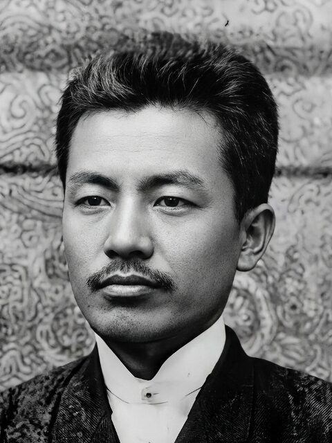
The beginning of the Naruto Bridge concept
(1889–1976)
Fifty years after the proposal by Okubo Jinnojyo, the idea of building a bridge to connect Honshu and Shikoku began to move closer to reality. The key figure at this stage was Chujiro Haraguchi (1889–1976), a civil engineer who would later serve as mayor of Kobe. While serving as head of the Kobe Civil Engineering Office, Haraguchi announced a plan in April 1940 to build a bridge across the Naruto Strait. He was later elected mayor of Kobe in 1949. Known as a “technocrat mayor,” Haraguchi began actively lobbying business leaders in Kobe and the national government (the former Ministry of Construction) around 1953 to support building a bridge along the Akashi–Naruto route. Around this time, Kobe City also launched its own independent surveys and studies.
However, constructing a suspension bridge across the Akashi Strait, which spans nearly 4 kilometers, would have meant building by far the longest suspension bridge in the world at the time. The technical challenges were overwhelming: strong winds, powerful tidal currents, and the need to withstand earthquakes, which are a constant concern in Japan. The difficulty was almost beyond imagination. In fact, construction of the Akashi Kaikyo Bridge did not begin until 1986, and it took 12 years to complete, finally opening in 1998. From Haraguchi’s initial actions to completion, a total of 45 years had passed.
The Imabari–Onomichi route and Sunada
Just as it took 45 years to complete the Akashi–Naruto route, it is often said that the opening of the Shimanami Kaido also took 45 years from its initial proposal. In May 1999, with the opening of the Kurushima Kaikyo Bridge and the Tatara Bridge, all bridges along the Imabari–Onomichi route—what we now call the Shimanami Kaido—were finally completed. This marked the culmination of a process that began with the opening of the Omishima Bridge in 1979 and took another 20 years to finish. Local newspapers at the time of the full opening carried large headlines featuring the phrase “a long-cherished dream of 45 years.”
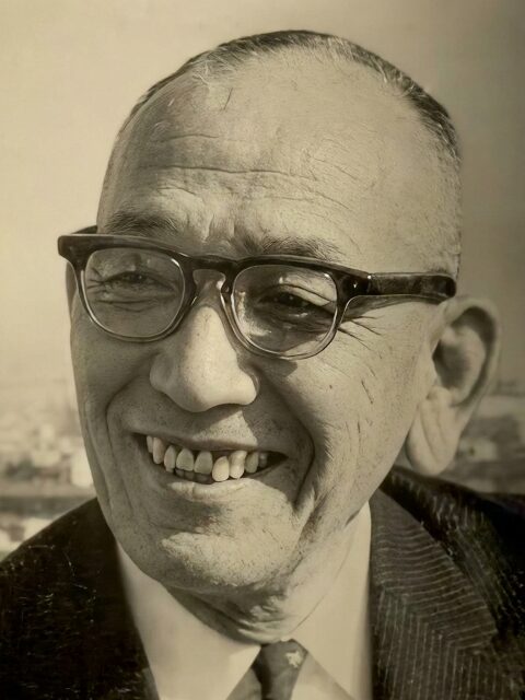
(1884–1957)
This “45-year” period is generally counted from 1954, when Shigemasa Sunada (1884–1957), a Diet member from Imabari, proposed the construction of the Imabari–Onomichi route. Sunada was elected to the House of Representatives nine times, but this proposal came at a transitional moment in his political career: he lost his seat in 1953 and then ran again from a different political party, winning re-election in 1955. It is easy to imagine that, at a time when he was aiming to regain support in his Ehime constituency, he put forward the construction of a route linking Ehime and Hiroshima prefectures as a flagship policy proposal. After returning to office, he later went on to serve as Director General of the Japan Defense Agency.
It is worth noting that the Imabari–Onomichi route envisioned at that time did not include a bridge across the Kurushima Strait. Building a nearly 4-kilometer-long bridge over one of Japan’s strongest tidal currents was considered unrealistic. Instead, the route was proposed as a combination of bridges and ferry transport, with ships used to cross this particularly challenging section.
This is more like my own personal research, so I hope you’ll read it just as a reference.
AD (Google AdSense)
A turning point in the movement to build bridges
The sinking of the Uko Ferry
One event often cited as a decisive trigger for the concrete progress toward building the Seto Ohashi Bridge was the sinking of a Japanese National Railways Uko ferry in May 1955. The ferry Shiun Maru, which operated between Uno in Okayama Prefecture and Takamatsu in Kagawa Prefecture, collided at sea with a JNR freight vessel, the Daisan Uko Maru, and sank. A total of 168 people lost their lives in this tragic accident, including many schoolchildren on a class trip. This was not an isolated case: in the era when travel between Honshu and Shikoku relied solely on sea routes, maritime accidents such as collisions and sinkings occurred repeatedly. These incidents gradually fueled public support for the movement to build bridges.
![[Photo] The history of the Shimanami Kaido: the sinking of a Japanese National Railways Uko ferry (early morning of May 11, 1955). Image created using generative AI.](https://touring-shimanami.com/wp-content/uploads/2023/12/ukourenraku-jiko.jpg)
In fact, during its eight years in service, the Shiun Maru was involved in five contact or collision incidents, and it sank twice, including the 1955 disaster mentioned above. Notably, the year 1955—when the Shiun Maru accident claimed the greatest number of lives—came just one year after the Toya Maru disaster, in which the Seikan ferry connecting Aomori and Hokkaido sank in a typhoon, resulting in more than 1,000 deaths and missing persons. It is easy to imagine how profound the social impact of these successive tragedies must have been.
It is obvious to anyone that building bridges between Honshu and Shikoku would require an enormous amount of time, effort, and money—an undertaking of extraordinary difficulty. In the long process by which what once seemed like a dream gradually became a realistic goal, major incidents like these played a crucial role. The impact of such tragic accidents forced many people to confront the necessity of building bridges, so that travel across the sea could be made safer and more reliable.
Once the bridges were built, people could travel anytime — faster and more safely.
AD (Google AdSense)
Selecting the bridge routes
The start of detailed surveys and the decision to proceed
In the wake of the Shiun Maru accident, Japanese National Railways, which operated this ferry route, began investigating the Akashi–Naruto route. The following year, on the Ehime side, an organization called the Chugoku–Shikoku Link Road Construction Promotion Alliance was established to push the project forward. In 1959, the Ministry of Construction launched a full-scale study to determine whether it was technically feasible to build roads linking Honshu and Shikoku, including geological surveys and analyses of the potential economic impact. At this stage, five candidate routes—labeled A through E—were under consideration for connecting Honshu and Shikoku. Of these, Route E corresponds to what is now the Shimanami Kaido.
![[Illustration] The history of the Shimanami Kaido: created based on route selection materials from the Honshu–Shikoku Bridge Authority](https://touring-shimanami.com/wp-content/uploads/2026/02/A-Eplans.png)
In 1966, the Japan Society of Civil Engineers, which had been commissioned to conduct technical evaluations, released a report concluding that all five routes were technically feasible. Around the same time, Ehime Prefecture established the Seto Inland Sea Bridge Construction Promotion Committee and began actively campaigning for the Imabari–Onomichi route. Subsequent discussions took into account construction difficulty and projected costs, and in 1969 the Ministry of Construction and the Ministry of Transport decided, as part of the New Comprehensive National Development Plan, to narrow the options down to the three routes we know today, including the Shimanami Kaido. Priority was given to the construction of the Seto Ohashi Bridge.
Were three routes really necessary?
Why was it decided to develop not just one, but three routes: the Akashi–Naruto route linking Hyogo and Tokushima, the Kojima–Sakaide route connecting Okayama and Kagawa, and the Onomichi–Imabari route between Hiroshima and Ehime? It is easy to understand the logic that having multiple routes allows for detours and alternatives in emergencies, making travel more stable and reliable. Even so, there was active debate at the time over whether “three Honshu–Shikoku bridges were really necessary.”
Behind the decision to proceed with all three routes, however, one can see a strong consideration for the various prefectures in the Chugoku and Shikoku regions. On the Sanyo side of the Chugoku region—Hyogo, Okayama, and Hiroshima—and on the Seto Inland Sea side of Shikoku—Tokushima, Kagawa, and Ehime—large promotion groups emerged in each prefecture, often involving local business leaders, all campaigning to attract a bridge connection to their area. The bridge-building movement became highly active across all these regions. Of course, factors such as technical feasibility and construction costs were also taken into account, but in the end, every one of these prefectures gained a bridge connection.
Preparations for building these bridges progressed during Japan’s period of rapid economic growth, generally considered to span from 1955 to 1973. The New Comprehensive National Development Plan itself was a product of this era of large-scale, ambitious development. Deciding to “build all three routes at once” was a bold and confident choice. From the outset, each route was given a distinct role: the Awaji route provided the shortest connection between the Kansai region and Shikoku, while the Seto Ohashi Bridge was designed as a combined road-and-rail route, including railway lines such as the Shinkansen. Compared with these, the Shimanami Kaido developed a stronger connection to everyday life and tourism—qualities that ultimately led to it becoming a route that can be crossed on foot or by bicycle.
For the Imabari–Onomichi route, local residents asked for roads that could also be used as part of their daily lives.
AD (Google AdSense)
Building the bridges of the Shimanami Kaido
Connecting the Shimanami Kaido over 24 years
In 1970, the Honshu–Shikoku Bridge Authority was established, and preparations moved steadily toward the actual construction of the bridges. Although the simultaneous groundbreaking of the Honshu–Shikoku bridges had been scheduled for 1973, all projects were postponed due to the oil shock. In reality, it was not until 1975 that a cabinet meeting approved the start of construction on three bridges—the Omishima Bridge and the Innoshima Bridge on the Seto Ohashi route, along with the Onaruto Bridge. Construction of the Omishima Bridge finally began in December of that year.
![[Illustration] The history of the Shimanami Kaido: construction periods of the bridges (from groundbreaking to completion)](https://touring-shimanami.com/wp-content/uploads/2026/02/historybridges-e.png)
By the time the Kurushima Kaikyo Bridge, the Tatara Bridge, and the Shin-Onomichi Bridge were completed on May 1, 1999, opening all bridges of the Nishiseto Expressway, a full 24 years had passed since construction began on the Omishima Bridge in December 1975. Today, the Seto Ohashi Bridge, the Akashi Kaikyo Bridge, and the Kurushima Kaikyo Bridge feel like natural parts of the landscape, and Honshu and Shikoku are freely connected by three routes. Looking back, however, it is striking to realize the immense and often overlooked history of effort and perseverance that lies behind the ease of travel we now take for granted.
A brief history of the Honshu–Shikoku bridge project
Below is a simplified timeline summarizing the history of the long-running project to build bridges connecting Honshu and Shikoku. A more detailed chronology could certainly be created by including many additional events, but this table focuses on what I personally consider to be the most important milestones.
| Year | Overview of the Honshu–Shikoku Bridge Project |
|---|---|
| 1889 | Shinnosuke Okubo, a member of the Kagawa Prefectural Assembly, publicly proposed for the first time the idea of building bridges to connect Honshu and Shikoku. |
| 1940 | Tadajiro Haraguchi, head of the Kobe Civil Engineering Office, announced a plan to bridge the Naruto Strait. In 1953, Kobe City began its own independent survey. |
| 1954 | Shigemasa Sunada, a member of the National Diet from Imabari City, proposed the construction of the Imabari–Onomichi route. |
| 1955 | Following the Shiun Maru ferry disaster, movements to promote bridge construction became increasingly active in prefectures around the Seto Inland Sea. |
| 1959 | The Ministry of Construction began full-scale geological and economic surveys, taking over earlier investigations conducted by Japanese National Railways and other organizations. |
| 1969 | The national New Comprehensive National Development Plan formally included the construction of the three current routes, with the Seto Ohashi route given top priority. |
| 1975 | A cabinet decision approved the start of construction on the Seto Ohashi route, the Omishima Bridge, the Innoshima Bridge, and the Onaruto Bridge. |
| 1988 | The Seto Ohashi Bridge, connecting Okayama and Kagawa prefectures, fully opened to traffic, marking the first time Honshu and Shikoku were linked by a bridge. |
| 1998 | The Akashi Kaikyo Bridge, connecting Akashi in Hyogo Prefecture with Awaji Island, opened, completing the second Honshu–Shikoku route. |
| 1999 | The Tatara Bridge and the Kurushima Kaikyo Bridge opened, completing the third Honshu–Shikoku route and giving birth to the Setouchi Shimanami Kaido. |
AD (Google AdSense)
When did the cycling road begin?
Expressways and roads for daily life
“When did the Shimanami Kaido get a cycling road?” This is something I have personally wondered about for a long time, so I have looked into it by checking several books and reference materials. So far, I have not been able to find any clear record that says, “At this time, in this meeting, these people officially decided to allow bicycles and pedestrians on the bridges.” However, what has become clear is that from the very early planning stages of the Onomichi–Imabari route, there was a strong demand to include roads for the daily lives of the people living on the islands.
![[Photo] The history of the Shimanami Kaido: When did cycling roads on the bridges begin?](https://touring-shimanami.com/wp-content/uploads/2023/12/cyclingroadbridge.jpg)
One major difference between this route and the Seto Ohashi route or the Awaji route is that it passes through nine inhabited islands. One of the main goals of building the Honshu–Shikoku bridge routes was to significantly reduce travel time, so expressways were always a basic requirement for all three routes. In fact, travel between Imabari and Onomichi, which once took about 2 hours and 40 minutes by boat, now takes around 50 minutes thanks to the bridges and the completed expressway sections*.
*The Oshima Road and Ikuchijima Road opened in 2006.
What to do about the loss of ferry services
At the same time, the completion of the bridge route also meant a shift “from boats to cars.” Back then, the islands of the Geiyo Archipelago were covered by a dense network of ferry and passenger boat routes. Travel between the islands was frequent, and boats were the most important means of transportation for local residents. Once the islands were connected by bridges, it was obvious that these sea routes would decline. In fact, when the Shimanami Kaido opened, 17 routes were either discontinued or saw their services significantly reduced.
![[Illustration] History of the Shimanami Kaido: Ferry routes operating among the islands in the 1970s](https://touring-shimanami.com/wp-content/uploads/2026/02/70sferryroutes.png)
Of these 17 routes, six were completely discontinued: the Imabari–Mihara ferry, the Omishima Inokuchi–Ikuchijima Tarumi ferry, the Imabari–Onomichi high-speed passenger boat, the Hakatajima Kitaura–Ikuchijima Miyahara ferry, the Imabari–Omishima Seto high-speed passenger boat, and the Omishima Seto–Innoshima Habu high-speed passenger boat. Routes that were initially only reduced in frequency were gradually phased out as transportation shifted to express bus services. Compared to the peak years, very few sea routes remain today.
![[Photo] History of the Shimanami Kaido: When bridges are built, boats are no longer used](https://touring-shimanami.com/wp-content/uploads/2023/12/funetouminnoashi.jpg)
For island residents, the loss of ferry services with the completion of the bridges was a matter of survival. In fact, it seems that bridge construction was halted several times due to disputes over compensation for ferry operators. There is also a record showing that five passenger transport companies, which were forced to close their ferry businesses when the bridges opened, jointly established a new bus company. The bridges of the Shimanami Kaido were therefore expected to serve as replacement lifelines for daily travel—allowing people to cross between islands not only by car, but also by bicycle and on foot.
From everyday roads to a cycling route
Looking at the history this way, it becomes clear that from the very beginning of the Shimanami Kaido bridge project, there was a strong demand to include routes for everyday life. At the planning stage of the Imabari–Onomichi route, these were not tourist-oriented cycling roads or walking trails like we see today, but practical bicycle and pedestrian paths for daily use. In fact, traces of this original idea can still be seen on four bridges built in the earlier phase of the project: Omishima Bridge, Innoshima Bridge, Hakata Bridge, and Oshima Bridge.
![[Screenshot] History of the Shimanami Kaido: Aerial photo around Omishima Bridge from around 1980 (from the Geospatial Information Authority of Japan map)](https://touring-shimanami.com/wp-content/uploads/2023/12/1980omishima.jpg)
This aerial photograph shows the Nosegase Strait (between Hakatajima and Omishima), taken sometime between 1979 and 1983 and still viewable on maps from the Geospatial Information Authority of Japan. At that point, the expressway had only been completed between Hakatajima IC and Omishima IC. If you look closely, you can see that the cycling path leading onto the bridge already had almost the same shape it has today. On the southwest side of the bridge, the route appears to have been developed not as an expressway, but more like an ordinary road—or even a combined bicycle and pedestrian path.
On these bridges, including Omishima Bridge, the bicycle–pedestrian path and the lane for small motorbikes are not separated. Instead, the structure is divided left and right into an expressway side and a “daily life” side (on Innoshima Bridge, this division is vertical, with upper and lower levels). At first glance, bridges like Omishima Bridge may look as if they were originally built as four lanes (two in each direction), with one side later converted into a bicycle–pedestrian path and the other reduced to a single expressway lane. In reality, however, they were designed from the outset as a combination of a one-lane expressway and a separate route for everyday use.
The Nishi-Seto Expressway, which forms the Imabari–Onomichi route, was positioned as an improvement project for National Route 317, and the original plan specified that it would eventually become four lanes. In practice, many sections of the expressway were initially built as two lanes in order to prioritize early opening, while bridge sections were constructed with enough width to allow future expansion to four lanes. As a result, what could be considered the “extra” two lanes on the bridges were put to use as everyday routes, leading to the unique structure we see today.
This mixed-use design—where bicycles, pedestrians, and small motorbikes shared the same route—was later reconsidered in the next phase of construction. From Ikuchi Bridge onward, including Ikuchi Bridge, Tatara Bridge, and Kurushima-Kaikyo Bridge, the designs clearly separate bicycle–pedestrian paths from lanes for small motorbikes, making them much closer to what we now recognize as proper cycling roads. At the same time, access roads leading up to the bridges were also developed, with gentle gradients designed to meet everyday needs. These same gentle slopes are still used today as part of the cycling routes before and after each bridge.
I found that the bridges were designed from the beginning so bicycles could use them as everyday routes.
AD (Google AdSense)
Development after the opening of the Shimanami Kaido
The excitement at the time of opening
When Kurushima-Kaikyo Bridge, Tatara Bridge, and Shin-Onomichi Bridge opened and all the bridges of the Shimanami Kaido were finally completed, the atmosphere was reportedly one of incredible excitement and bustle. Between 5:30 p.m. on May 1, 1999, when the road was opened to the public, and May 2, the total traffic volume across the three bridges reached 75,315 vehicles. On Tatara Bridge, traffic reached four times the projected volume, while Kurushima-Kaikyo Bridge saw more than double its expected traffic, leading to severe congestion.
![[Photo] History of the Shimanami Kaido: A ride report on the Onomichi–Matsuyama highway bus at the time of opening (quoted from Ehime Shimbun, May 1, 1999)](https://touring-shimanami.com/wp-content/uploads/2023/12/kiraraex9jikan.jpg)
The Onomichi–Matsuyama highway bus service known as the “Kirara Express,” which operated on May 2, 1999, reportedly took an astonishing nine hours to cover a route that would normally take about two hours and forty minutes. At that time, parts of the expressway on Oshima were still unfinished, and the island’s ordinary roads became heavily congested, causing serious disruptions to daily life for local residents.
At Sunrise Itoyama, a cycling terminal that had opened earlier at the foot of Kurushima-Kaikyo Bridge, around 100 rental bicycles—including electric-assist bikes—were available. Even so, newspaper articles from the time report that reservations were fully booked for quite a while, and most visitors were unable to rent a bicycle. There are also records showing that a special “cycle train” service operated for a limited period between Matsuyama Station and Hashihama Station.
The Need to Improve Rental Bicycle Services
In the early days after the Shimanami Kaido opened, the emphasis seemed to be placed more on pedestrians than on cyclists—in other words, on the fact that it could be “crossed on foot.” Many walking-focused events were held, such as the “Setouchi Shimanami Kaido International Three-Day Walk” from April 22 to 24, 1999, while cycling events were relatively limited, including the “Kurushima-Kaikyo Bridge Opening Commemorative Cycling Event” on April 25, 1999. The number of bicycles available for rental was also small, and compared to cycling events, walking events likely had a lower barrier to organization in terms of traffic control and logistics.
![[Photo] History of the Shimanami Kaido: Excerpt from a dialogue between Governor Fujita and Governor Kato (quoted from Ehime Shimbun, May 1, 1999)](https://touring-shimanami.com/wp-content/uploads/2023/12/fujita-katotaidan2.jpg)
At the same time, newspaper articles from the period show that the value of the Shimanami Kaido as a “cycling route” was already being recognized. For example, in a discussion held around the time of the opening between Governor Yuzan Fujita (then Governor of Hiroshima Prefecture) and Governor Moriyuki Kato (then Governor of Ehime Prefecture), both acknowledged the importance of enhancing rental bicycle services. Governor Kato even spoke of an ideal system in which rental bicycles could be returned across prefectural borders, much like rental cars.
A period of decline and the rise of cycle tourism
In fact, it is not widely known that for about ten years after its opening, the Shimanami Kaido went through a period of stagnation in terms of tourism and the local economy. The number of public rental bicycle users was also on a downward trend, and in 2005 the annual number of rentals fell below 30,000 for the first time. Visitor numbers at tourist facilities that opened around the time of the route’s completion, such as the theme park “Citrus Park Setoda,” also struggled to grow.
![[Graph] Changes in the number of public rental bicycle uses (1999–2024)](https://touring-shimanami.com/wp-content/uploads/2026/02/rentalgraph-e.png)
Newspaper articles from the early 2000s often discussed the situation with a tone suggesting that “tourists only pass through the Shimanami Kaido, bringing little benefit to the island economies.” This reflects the so-called “pass-through phenomenon,” in which visitors used the expressway to cross the islands without stopping. As maritime transport options disappeared and ferry routes were discontinued, depopulation also progressed rapidly in communities around former ports.
Three turning points toward becoming a “Cycling Route”
Against this backdrop of regional challenges, recognition of the Shimanami Kaido’s value as a “route for cycling” gradually grew. This shift was driven by three major turning points.
1. Municipal Mergers
The first was a series of municipal mergers. In 2005, most towns and villages in Ochi District were merged into Imabari City, and between 2005 and 2006 the islands on the Hiroshima side were merged into Onomichi City. As a result, the ten municipalities that once lined the route were consolidated into just two cities, making it far easier to implement coordinated policies across the Shimanami Kaido region. Conversely, before these mergers, initiatives that crossed island boundaries required approvals from multiple local governments, making swift decision-making difficult. After the mergers, the usability of the rental bicycle system was also improved.
2. The Rise of Civic Movements
The second turning point was the emergence of civic movements and grassroots activities aimed at revitalizing the Shimanami Kaido as a cycling route. This can be seen as the true beginning of cycle tourism in the area. Around 2005, local citizens began developing model cycling courses, and in 2008 the “Shimanami Slow Cycling Council” was established to promote regional revitalization through citizen-led initiatives. The following year saw the founding of the NPO “Cyclo-Tourisme Shimanami,” dedicated to the promotion of cycle tourism.
3. Governor Nakamura of Ehime Prefecture
The third was a major change on the administrative side. In 2010, Tokihiro Nakamura took office as Governor of Ehime Prefecture. Known as a governor who personally enjoys cycling, he formulated the “Ehime Marugoto Cycling Road Concept,” co-hosted the international cycling event “Cycling Shimanami” with Hiroshima Prefecture, and established a Bicycle New Culture Promotion Office within the prefectural government. Through these efforts, he actively promoted cycling culture. Today, both Ehime and Hiroshima prefectures are working proactively to promote and develop the Shimanami Kaido as a world-class destination for cycling.
The process of how bicycle travel was promoted has also been studied, and several academic papers have been published.
The Shimanami Kaido opens up to beginners
Along with these changes, the cycling environment on the Shimanami Kaido has improved rapidly over the past decade. In 2014, it was selected as one of the “World’s 7 Greatest Cycling Routes” by CNN’s travel website, and in 2019 it was designated by Japan’s Ministry of Land, Infrastructure, Transport and Tourism as one of the country’s first National Cycle Routes. Through such recognition, the Shimanami Kaido has become widely known as a cycling route that meets global standards, and today cyclists from around the world come here to enjoy bicycle travel.
![[Illustration] Cycling routes in Japan: Routes registered as National Cycle Routes](https://touring-shimanami.com/wp-content/uploads/2026/01/nationalcycleroute.png)
| National Cycle Route | Main Prefectures | Length |
|---|---|---|
| Tsukuba–Kasumigaura Rinrin Road | Ibaraki | Approx. 180 km |
| Biwaichi | Shiga | Approx. 193 km |
| Shimanami Kaido Cycling Route | Hiroshima, Ehime | Approx. 70 km |
| Tokapuchi 400 | Hokkaido | Approx. 403 km |
| Pacific Coast Cycling Route | Chiba, Kanagawa, Shizuoka, Aichi, Mie, Wakayama | Approx. 1,487 km |
| Toyama Bay Cycling Course | Toyama | Approx. 102 km |
Today, more than 300,000 bicycles travel the Shimanami Kaido each year. In the past, most riders were experienced cyclists on sports bikes, but now nearly half of all riders are first-time cycling travelers. Renting a bicycle and aiming to complete the full Shimanami Kaido route has become a popular and accessible way to enjoy cycling in Japan.
The Shimanami Kaido becoming more accessible for beginners
Along with these changes, the cycling environment on the Shimanami Kaido has improved dramatically over the past decade. In 2014, it was selected as one of the world’s seven greatest cycling routes by CNN’s travel website, and in 2019 it was designated as a “First National Cycle Route” by Japan’s Ministry of Land, Infrastructure, Transport and Tourism. Through these milestones, the Shimanami Kaido has become widely recognized as a world-class cycling route, and travelers from around the globe now come here to enjoy cycling journeys.
AD (Google AdSense)
The internationalization of the Shimanami Kaido
The sharp increase in the number of foreign visitors to Japan between 2014 and 2019 also reached the Shimanami Kaido. When I actually ride here, I truly see foreign cyclists everywhere. At bicycle rental terminals, on the bridges, and at island cafés and accommodations, hearing many different languages has become an everyday, international scene.
![[Graph] Number of public bicycle rentals on the Shimanami Kaido by foreigners and Japanese (2012 to 2024)](https://touring-shimanami.com/wp-content/uploads/2026/02/graph4-e-1.png)
It is often said that the Shimanami Kaido is rapidly becoming more international, but surprisingly little is discussed about “which countries visitors come from, how many people there are, and how they actually ride the Shimanami Kaido.” On this webpage, I examine the growth of foreign visitors to the Shimanami Kaido and the factors behind it, using data on bicycle traffic volumes and public rental bicycle usage by country.
On this page, I have introduced the 45-year history leading up to the completion of the Shimanami Kaido. One of its greatest features is that even beginners can enjoy cycling here with confidence and peace of mind. I have gathered more detailed information about cycling on the Shimanami Kaido on the page below, so please take a look if you are planning a trip or want to learn more.